
mkcobabnclhdodfhajlagglahfhkeeon


Add thrill to your cycling route planning by hunting squadrats. Use Strava, Garmin, RideWithGPS, and other planners. No more meaningless rides. Turn your cycling trips into thrilling missions! This extension combines the power of Squadrats with your favourite route planning tool. Supported planners: * Strava * Garmin Connect * RideWithGPS (activities in Strava or Garmin) * Komoot (IMPORTANT: activities must be in Strava or Garmin) * Hammerhead Karoo (IMPORTANT: activities must be in Strava or Garmin) * and others Now you can use these tools to plan your activities so precisely, that you never miss a single squadrat! A squadrat is a mile by a mile squarish thing on the map. The idea is to go out, collect them, and connect them, forming larger chunks of land. By doing so, you'll visit strange places and amuse yourself with all the things you missed in your close neighbourhood. It will also make your cycling activities fun again. Don't have time for all-day rides? No problem. Switch to squadratinhos - tiny squadrats. Chase them on your way to work.

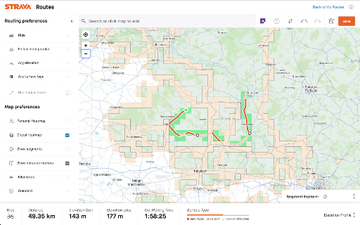
Strava, export gpx track
Added button to map in activities, segments and routes Full export only with your auth.

VeloViewer Strava Plugin
Additions to Strava website to provide helpful links and features for VeloViewer. Add direct links from within Strava to VeloViewer along with other, VeloViewer specific additions. - Top level VeloViewer menu providing direct links to your key pages on VeloViewer. - Direct links to VeloViewer segment details page throughout the Strava site. - Direct links to Activities. - Direct links to Routes. - Direct links to Club yearly leaderboards. - VeloViewer Explorer tiles highlighted in Strava Route Builder including completed tiles, max square(s) and max cluster. - Chronological ordering on your dashboard feeds. 1.49 - Map Switcher bug fixed. 1.48 - Update to handle new Strava Route Builder map. Explorer Tile overlay will no longer work in 3D map mode so logic introduced to switch to 2D when Tile shown. 1.47 - Bug fix to handle update to Strava. 1.46 - Bug fix to last version. 1.45 - Technical update to change the way JS file is loaded. 1.44 - Bug fix to show newly ticked tiles for planned route in updated Strava Route Builder. 1.43 - Update to handle new Strava Route Builder changes for showing Explorer Tiles. 1.42 - Some minor bug fixes to handle some rare exceptions. 1.41 - Change in default Chrome security settings has blocked the way to automatically get your ticked Explorer Tiles from VeloViewer. Functionality added to allow you to copy a user-specific code from VeloViewer Summary page which can be pasted into the Strava Route Builder page which allows a secure connection to get your ticked tile data. 1.40 - Explorer error message wasn't being displayed on Route Builder page if not logged in. Also tidied up code that generates Explorer tile option. 1.39 - Another fix to route builder page to handle slight change in Strava's HTML structure. 1.38 - Fix to route builder page to handle slight change in Strava's HTML structure. 1.37 - Previous fix failed when Strava site viewed in language other than English. Hopefully now fixed for other languages too. 1.36 - Fix on Route Builder to when incorrect text showing on Explorer tile toggle. Also tweak to the main menu layout. 1.34/1.35 - Fix to handle change in React code on Route Builder. 1.33 - Changes to support FireFox. 1.31 - Update to Route Builder Explorer Tiles to handle no structure of menus. Link to VeloViewer corrected on the Segment Details page. 1.30 - A small change to the Route Builder Explorer tiles overlay to work more smoothly with other map-switcher extensions. 1.29 - Hopefully the final bug fix around tiles being shown as newly ticked tiles when already ticked! 1.28 - Another bug fix around tiles being shown as newly ticked tiles when already ticked. 1.27 - Explorer tile lines added to map (only shown when map zoom > 10). Bug fixed around false newly ticked tiles being shown. 1.26 - Tweaks to Route Builder code to handle expected className changes when Strava rolls out updates. Ticking of previously missed new tiles between route points included. Slight difference in opacity of clustered tiles that aren't part of max cluster. 1.25 - Rework for Explorer Tiles to work with new Strava Route Builder. New tiles ticked by route now highlighted. Configure tile colours in map settings on Activities page in VeloViewer. I'll try and get Personal Heatmaps showing again next. 1.24 - Turns out it is nothing to do with "SameSite" mode. Explorer tiles not loading due to "Block third-party cookies" setting being enabled. Added code to catch the situation and redirect to blog post with instructions to add "veloviewer.com" to "Allowed" list on chrome://settings/content/cookies 1.23 - Hopefully fixing an issue for users with "SameSite" mode enabled on Chrome for showing completed Explorer tiles in Route Builder. 1.22 - Moved the text (informing the user to log into VeloViewer in order to see their Explorer tiles in the Route Builder) to the top of the menu to hopefully make it more obvious. 1.21 - Completed explorer tile info now retrieved in a more secure way. Also a slight UI change to stop menus wrapping on a smaller screen. 1.20 - A strange issue with Chrome caching the Explorer Tiles file with the origin set to VeloViewer or Strava resulting in it not being able to be loaded in the other site. Worked around the issue in the extension to get the data in a different way. 1.19 - Update to unexplored tile KML download to fix bug caused by new version of Chrome. 1.18 - VeloViewer link from Activity Details updated to work with new Strava page structure. 1.17 - Personal Heatmaps option added to Route Builder. Works with Ride and Run All-Time heatmaps (Summit users only). 1.16 - Athlete Id added to Activities links to enable the deep link to Activity Details to work post GDPR. 1.15 - Club yearly leaderboard links added. 1.14 - Changed the "Chronological" button to now offer two options, either by sort by activity start date/time or by activity upload date/time. Activity end time isn't easily doable I'm afraid. 1.13 - "Chronological" button added to Dashboard to allow the sorting of activities by start date/time. 1.12 - Correction to KML export: colour changed to aabbggrr (eh?!) 1.11 - KML download for unvisited tiles for current area in the Route editor. 1.10 - Explorer Clump added to Route Builder. Custom colours for Explorer tiles brought in from configuration on user's Activities List page in VeloViewer. 1.9 - Minor tweak to test something out. No new functionality though. 1.8 - Fixed (hopefully) a browser zoom issue that wasn't quite fixed in 1.7. 1.7 - Update to handle browser zoom with explorer tiles. Also remembers whether explorer option was on or off between sessions. 1.6 - Explorer tile logic updated to handle Leaflet map (which looks to be replacing the Google Map on the Route Builder); Explorer tile borders/background set to white when using satellite view for better contrast. 1.5 - Large performance improvement on initial load of route builder if you have a lot of explorer tiles ticked off. 1.4 - Max explorer square(s) now shown. All links to VeloViewer are now https. 1.3 - Route builder now shows explorer tiles at all most zoom levels and on all map types. Completed tiles are now shaded 1.2 - Explorer tile outlines now work on retina displays 1.1 - Tweaked to work alongside Stravaistix 1.0 - Initial version

Wandrer Map Overlay
View your Wandrer map data in a variety of route planning tools, including Strava, Komoot and RideWithGPS The Wandrer Map Overlay Extension lets you view your Wandrer map data in many popular route planning tools, making it easy to plan routes that take you new places. About Wandrer Wandrer is the outdoor game that you win by going places you've never been before. The main rule is: you get credit for every road you travel, but only once. So if you want to progress, you have to go new places. Find out more at https://wandrer.earth/ Version History: 2.0.0.16: Restore Garmin functionality 2.0.0.15: Strava fixes 2.0.0.14: RideWithGPS fixes 2.0.0.13: Komoot and BikeRouter fixes 2.0.0.11: More RideWithGPS fixes 2.0.0.10: Restore RideWithGPS compatibility 2.0.0.9: Fix issues with Garmin, Strava, and Komoot 2.0.0.8: Fix issues with Garmin, Plotaroute and Bikerouter 2.0.0.7: Improve compatibility with Strava and RideWithGPS 2.0.0.6: Address an issue with the BRouter bookmarklet 2.0.0.5: Unique distance calculation is now done by clicking a "calculate" button, rather than after every change to the route. This lightens the load on Wandrer's servers and also makes it possible to report achievement data too (forthcoming) 2.0.0.4: Fix MapMyRide/MapMyRun compatibility 2.0.0.3: Improved stability with Komoot, Strava and Bikemap 2.0.0.2: Fix Komoot compatibility, improve behavior in long routes with Strava 2.0.0.1: Manifest V3 rewrite 1.0.0.63: Restore Strava compatibility 1.0.0.61: Fix compatibility with MapMyRide/MapMyRun 1.0.0.60: Fix Komoot compatibility 1.0.0.59: Fix Garmin compatibility 1.0.0.58: Some small Bikemap and Komoot fixes 1.0.0.57: Restore compatibility with Bikemap 1.0.0.56: Add support for Google map layers in RideWithGPS and fix a bug around display of untraveled roads. 1.0.0.55: Partial fix for RideWithGPS and the Wandrer extension. The Google maps layers are not yet functional, but all others should be. 1.0.0.54: Improve compatibility with Strava, RideWithGPS, and Garmin 1.0.0.53: Fix a bike/foot icon swap in RideWithGPS 1.0.0.52: Add support for toggling paved and unpaved road visibility 1.0.0.51: Update compatibility with RideWithGPS 1.0.0.50: Go someplace together! You can now display the Wandrer data for two additional friends directly in the extension to help you plan routes together. Also fix a RideWithGPS rendering issue. 1.0.0.48: Fix compatibility with Garmin and Komoot route planners 1.0.0.47: Bugfix with changing map type on Komoot 1.0.0.46: Bugfix with Strava data display 1.0.0.45: Bugfix with Komoot data display 1.0.0.44: Bugfix with Strava data display 1.0.0.43: Bugfix with Komoot data display 1.0.0.42: Bugfix with distance reporting in MapMyRide/MapMyRun 1.0.0.41: Bugfix with distance reporting in Strava 1.0.0.40: Bugfix with distance reporting in Komoot 1.0.0.39: Show Wandrer data in additional Veloviewer maps and display traveled + unpaved roads as dashed lines 1.0.0.38: Add support for viewing Wandrer map data in the Veloviewer explorer 1.0.0.37: Fix display with different map layers in Komoot. 1.0.0.35/36: Fix a bug in the previous version where map layers weren't showing correctly. 1.0.0.34: Set default road layer colors 1.0.0.33: Improve the color picker, allowing setting of transparency 1.0.0.32: Fix RideWithGPS styling to be more consistent with other sites and the Wandrer site. 1.0.0.31: Bugfixes with the Strava route planner. 1.0.0.30: Add support for Garmin Connect route maker and fix some bugs around displaying new length 1.0.0.29: Hopefully address a bug with the extension key not being properly saved. 1.0.0.28: Bugfixes 1.0.0.27: Add early support for activities on foot 1.0.0.25: Bug fix with the popup window size being too small in Chrome 94 1.0.0.24: Bug fix with changing map styles on Komoot 1.0.0.23: Bug fix with calculating route length on Strava 1.0.0.22: More bug fixes 1.0.0.21: Bug fixes with Strava 1.0.0.20: Bug fixes 1.0.0.19: Add support for BikeRouter 1.0.0.18: Bug fixes 1.0.0.17: Added support for dynamicWatch and improved Komoot compatibility 1.0.0.16: Updated to work with Komoot once again! 1.0.0.15: Added support for Bikemap.net 1.0.0.14: Bug fixes (better Komoot support, preserve color choices after sign-out/sign-in) 1.0.0.13: Add MapMyRide/MapMyRun and Plotaroute support 1.0.0.11: Add different styling for "unpaved" roads, displaying them as dashed lines 1.0.0.10: Fix an issue with the extension not loading on Komoot route edit pages 1.0.0.9: Fix an issue with the extension not loading on Strava route edit pages 1.0.0.8: Add support for additional Komoot websites 1.0.0.7: Add support for Komoot route planner 1.0.0.6: Fix a bug where some roads were incorrectly shown as ridden in RideWithGPS 1.0.0.5: Add missing support for Strava route edit pages 1.0.0.4: Adds support for the Strava route planning tool 1.0.0.3: Also display Wandrer map data in the RWGPS route edit view 1.0.0.2: Added a live tally of the expected new length for the route, displayed under the extension's icon 1.0.0.1: Added the ability to change the color of traveled and untraveled road layers 1.0.0.0: Initial release

StatsHunters
To make it easier to create new routes to achieve new tiles you can use the StatsHunters Chrome extension to show tiles on different route builders. 1. Install the extension 2. Login to StatsHunters and copy the API-code from the settings page 3. Click the StatsHunters Chrome extension icon and past the API-code 4. Go to one of the route builders 5. Start building new routes You can use the plugin on different websites, the following sites are supported: Strava, Komoot and others. Check the full list on https://www.statshunters.com/faq